|
|
SiteWorx/OS Version 10 Now Available
SiteWorx/OS works with PDF, Layered/Vector PDF, TIFF, JPEG, BMP, DWG, DXF and many other raster and vector CAD files. Quickly enter project boundaries, contour lines, point elevations, areas, boring logs, trenches and topsoil strip and respread areas. Once information is recorded, SiteWorx/OS automatically creates 3D models and accurately calculates cut, fill volumes and areas with subgrade volumes.
|
|
|
Features:
- Easy trace of lines when working with raster files
- Easily import countour lines and point elevations from DWG files
- Isolate design layers to eliminate irrelevant data when using vector PDF and DWG files
- Record an entire object with a single cick when using vector PDF and DWG files
- Automated checking reduces errors
- Site balancing
- Overcuts on areas
- Subgrade volumes by material type
- Cut, fill, topsoil strip and topsoil respread volumes
- Boring Log input provides cut volumes by soil type
- Calculates trench materials and volumes
- 3D and cross section site display
- Export results to Microsoft Excel, Word and other programs
SiteWorx/OS has an extensive reporting capability. Reports include, but are not limited to:
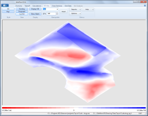
- 3D Graphics of the existing and proposed site
- Cut and Fill Grid Report gives you the cut and fill volume for each grid along with the cut and fill depth at each corner of every grid
- Takeoff Report shows you the plan view of the site with project boundaries, contour lines, points and areas
- Area Reports identify measured areas along with subgrade, cut and fill volumes
- Material Report display subgrade volumes across all areas
- Soil Analysis Reports, when using boring logs, provides soil type information on the site cut
- Cross Section Reports provide vertical and horizontal slices through the project showing existing and proposed elevations
Reports can be easily exported to Excel, Word, PDF, HTML and other formats.
Vertigraph offers live personal demonstrations over the internet. These software product demos will address your specific questions and needs. Approximate time per demo is fifteen minutes. Schedule an on-line demonstration today to see how SiteWorx/OS works for you.
Or, download a working copy of SiteWorx/OS and test drive its ease of use. After downloading and installing, please view the tutorial and help file for instructions on use.
SiteWorx/OS System Requirements
Download full featured SiteWorx/OS Evaluation
Schedule an on-line demonstration of SiteWorx/OS.
|

Click for larger image
|
SiteWorx/OS Version 10.0 Now Available
SiteWorx/OS Version 8.0 is now available for download. Version 8.0 includes:
- Improved drawing management
- Open and work with multiple file types
- Improved calculation of boring log data
- Enhanced Layer Selection
- Improved performance for Snap to Entity Point and Select Entity
To upgrade to Version 8.0 download and install the SiteWorx Version 8 Installation file. New users wishing to try Version 8 should also download the SiteWorx Version 8 Installation file. The file can be found on the downloads page along with installation instructions.
Note: SiteWorx/OS requires Windows 7 or later operating system.
|
The following SiteWorx/OS documents are available for download:
Installation Instructions (328KB)
Tutorial (1.7 MB)
SiteWorx OS Brochure (1.7 MB)
 |
|
SiteWorx/OS Version 7 Tutorials
New Window will open to view these from the Vertigraph Page
|
Chapter 1
Introduction – Overview Tab and Opening Files |
|
Chapter 2
Takeoff tab – Project Boundary, Contour Lines, Point Elevations and Sloping Design Lines
|
|
|
Chapter 3
Takeoff Tab – Area Elevations
|
|
Chapter 4
Takeoff Tab - Topsoil Regions
|
|
Chapter 5
Calculations and 3D View Tab
|
|
Chapter 6
Review your Project |
|
Chapter 7
Boring Logs |
|
Chapter 8
Importing Elevations from AutoCad DWG Files
|
|
|